Plan your motorbike journey easily with this custom Ha Giang Loop map. It includes major towns, scenic passes, accommodation, and local highlights.
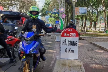
📍Start your journey at Km0 in Ha Giang Center, follow the loop through Quan Ba, Yen Minh, Dong Van, Meo Vac, Du Gia, and return to the starting point.
Tips for Using the Map:
- Zoom in to find homestays, viewpoints, and attractions
- Click each marker to see descriptions or notes
- Use the legend on the left to toggle layers (towns, roads, highlights)
- Save the map to your own Google account for offline planning
Why You Need a Map for the Ha Giang Loop
Navigating the Ha Giang Loop without a proper map can be challenging, especially with limited mobile signals in remote areas. Whether you’re planning to ride solo or join a tour, having a detailed Ha Giang Loop map helps you:
- Plan your route and timing
- Find gas stations and homestays
- Identify must-see spots and hidden gems
- Stay safe in unfamiliar terrain
See more: The Ultimate Guide to the Ha Giang Loop
Ha Giang Loop Map Overview

Here is a breakdown of the most popular loop route:
Standard 3–5 Day Route:
- Ha Giang Center (Km0) → Quan Ba
- Distance: 50 km
- Highlights: Heaven’s Gate, Twin Mountains
- Quan Ba → Yen Minh
- Distance: 60 km
- Highlights: Rice terraces, pine forests
- Yen Minh → Dong Van
- Distance: 50 km
- Highlights: Hmong villages, Dong Van Old Quarter
- Dong Van → Meo Vac (via Ma Pi Leng Pass)
- Distance: 22 km
- Highlights: Ma Pi Leng Pass – the most scenic viewpoint on the loop
- Meo Vac → Du Gia → Ha Giang Center (Km0)
- Distance: ~150 km
- Highlights: Waterfalls, traditional stilt houses
Having a reliable Ha Giang Loop map is essential for a smooth and unforgettable journey through one of Vietnam’s most stunning regions. With the right preparation, you’ll be ready to tackle every turn, climb every pass, and immerse yourself in the rich cultural tapestry of Ha Giang.